One of the more important tasks I have undertaken over the past few months is to update the maps of the collection. These are hand written and have been much amended and annotated over the years. Each section has been checked, noting where plants are missing, have been replaced or additions made. I have then scanned each map to create a digital file which I have then edited. I have then given each individual plant a unique number, nothing complicated, just its area followed by a three digit number. As appropriate, the master record, in the form of a spreadsheet, has been updated.

Much amended original of area 1P.
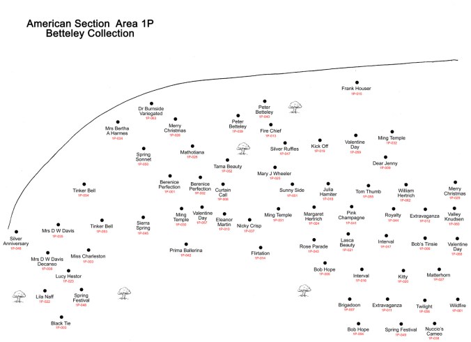
Revised map of area 1P
I have photographs of a large proportion of the plants in the collection but because there has been no numbering system, it will be tricky to relate photos to individual plants if there is more than one of a kind. My intention is to have a set of photos of each plant, taken over several seasons. My aim then will be to confirm the given name or identify incorrect names and if possible correct them.
I will put all the maps onto this site along with a layout map showing where each section is. I will also put a full list of the taxa in the collection with their locations.
